Tôlanaro & the South
Gateway to Cape Sainte Marie, secluded bays and the wild landscapes of southern Madagascar.
Tôlanaro & the South
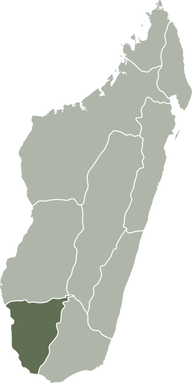
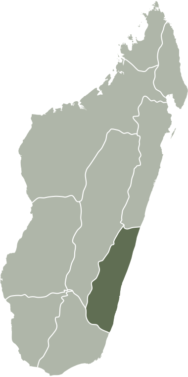
For years, Madagascar’s far south was strictly reserved for experienced 4×4 adventurers. Thanks to recent road upgrades along the RN10 and RN13, remote areas like the southernmost point, Cap Sainte-Marie, are now also accessible to adventurous travellers. This is how we connect Tôlanaro (Fort-Dauphin) via the dry spiny forest area in the south and off the beaten tracks in the west with the coastal city of Toliara.
Tôlanaro itself still lies on the humid southeast coast, but barely 50 km away the landscape changes completely: a dry and expansive savanna, with it’s unique spiny forest. The road is paved as far as Tsihombe; after that, you drive over tracks through a labyrinth of cactuses – the homeland of the Antandroy tribe – all the way down to Cap Sainte-Marie. Further west, you arrive at beautiful beaches with plenty of opportunities for surfing and diving.
Highlights
Tôlanaro region & the south
Tôlanaro (Fort-Dauphin)
Tôlanaro is the endpoint of national road RN12 and the beginning of the RN10 and RN13. In the 17th century, the French built a fort here that they named after the French crown prince (Dauphin = crown prince). For a long time, it remained a modest fishing village, until one of the largest mining companies in the world acquired a concession here. In no time, Tôlanaro grew into a bustling town with its own port, employment opportunities, and a clear corporate culture. But also: beautiful bays, oysters, surfing, hiking, and mountain biking on Pic Saint-Louis, where mountains and sea meet.
Berenty Reserve
About 60 km west of Tôlanaro, a surprising phenomenon appears. Large sisal plantations stretch along the Mandrare River: a species of agave processed into fibers for industries including the automotive sector (insulation material). Within this agricultural area lies a piece of original spiny forest that was left untouched: the Berenty Reserve. This private reserve is known worldwide among nature lovers for its high concentration of lemurs, especially the ring-tailed lemur and the sifaka, which you can spot up close here. Anyone wishing to stay overnight can do so at the well-known Berenty Lodge, right in the heart of the reserve.
Ambovombe and Tsihombe
If you drive further along the RN13, you arrive in Ambovombe. Traditionally, this is the last place to fill up the tank of your 4×4 before heading into the real wilderness! After that, the paved road (RN10) continues until Tsihombe. This is where you leave the tarmac behind and hit the dirt tracks, entering an area full of cactuses as far as the eye can see. You are literally driving through a real maze of cactus plants.
Something very special here is the radiated tortoise. This is a threatened species, but thanks to a local taboo on eating them, they still live here in good numbers. They walk calmly right across the tracks, so you will often need to hop out of your car to gently move them to the side.
Cap Sainte-Marie Special Reserve
On your way to Cap Sainte-Marie – the southernmost point of Madagascar – you travel through the wide and quiet land of the Antandroy people. They are a local tribe that has adapted perfectly to the dry and tough climate of this region. Here and there, small villages appear with wooden huts, some cattle, and cassava fields. The Antandroy wear traditional clothing, carry walking sticks and spears, and bury their loved ones in striking, brightly colored tombs.
Standing on top of the rugged cliffs at Cap Sainte-Marie, you feel the full power of the ocean; the exact spot where the Indian Ocean meets the Mozambique Channel. Besides the spectacular views, the protected reserve on the cape is home to a unique landscape of cactuses and a healthy population of radiated tortoises. The ideal base to explore all of this is the lovely village of Lavanono, famous among surfers and just a one-hour drive from the Cap.
Itampolo and Tsimanampetsotsa National Park
Heading further west, we reach Itampolo, our next stop along this route. On the way, you cross two rivers without ferry connections: they are usually dry, but not always. It is always best to check the local conditions on the spot. The most exciting way is to stick as close to the coast as possible, but if there is too much water, you can easily detour inland towards the RN10.
Itampolo itself will surprise you with its stunning sea and beaches. From here, it is a short trip to Tsimanampetsotsa National Park, home to its famous and striking salt lake. The name “Tsimanampetsotsa” roughly means “there are no dolphins here”: a fun local joke pointing out that the lake is completely landlocked, no open sea water. Here you will see plenty of flamingos searching for food in the shallow, mineral-rich water. The park is also home to some of the oldest baobabs on our island.
Toliara
Via Anakao, a great spot for surfing and diving, you travel further to the port town of Toliara on the southwest coast. You can get there either by boat or by car along the RN10 via Andranovory. The regional airport in Toliara is super convenient for your travel plans, whether you are just starting or wrapping up your journey.
Madagascar.
Welcome
to our home.